Table of Contents
<ul> <li class="first"> <a href="#2014-01-01-another-trip-t">2014-01-01 Another trip to Sycamore Creek</a> </li> <li> <a href="#2014-01-04-petrified-nati">2014-01-04 Petrified National Park, Natural Arches, and Monument Valley</a> </li> <li class="last"> <a href="#2014-03-22-death-valley-w">2014-03.22 Death Valley with Tony</a> </li> </ul>Here is a collection of pictures I have taken from my travels around the American Southwest in 2014.
2014-01-01 Another trip to Sycamore Creek
Sycamore Creek is an easy 1 hour drive from my flat, so it is my go to camping location.

2014-01-01 On New Year's Day I returned to Sycamore Creek and hiked up to Sunflower Mine
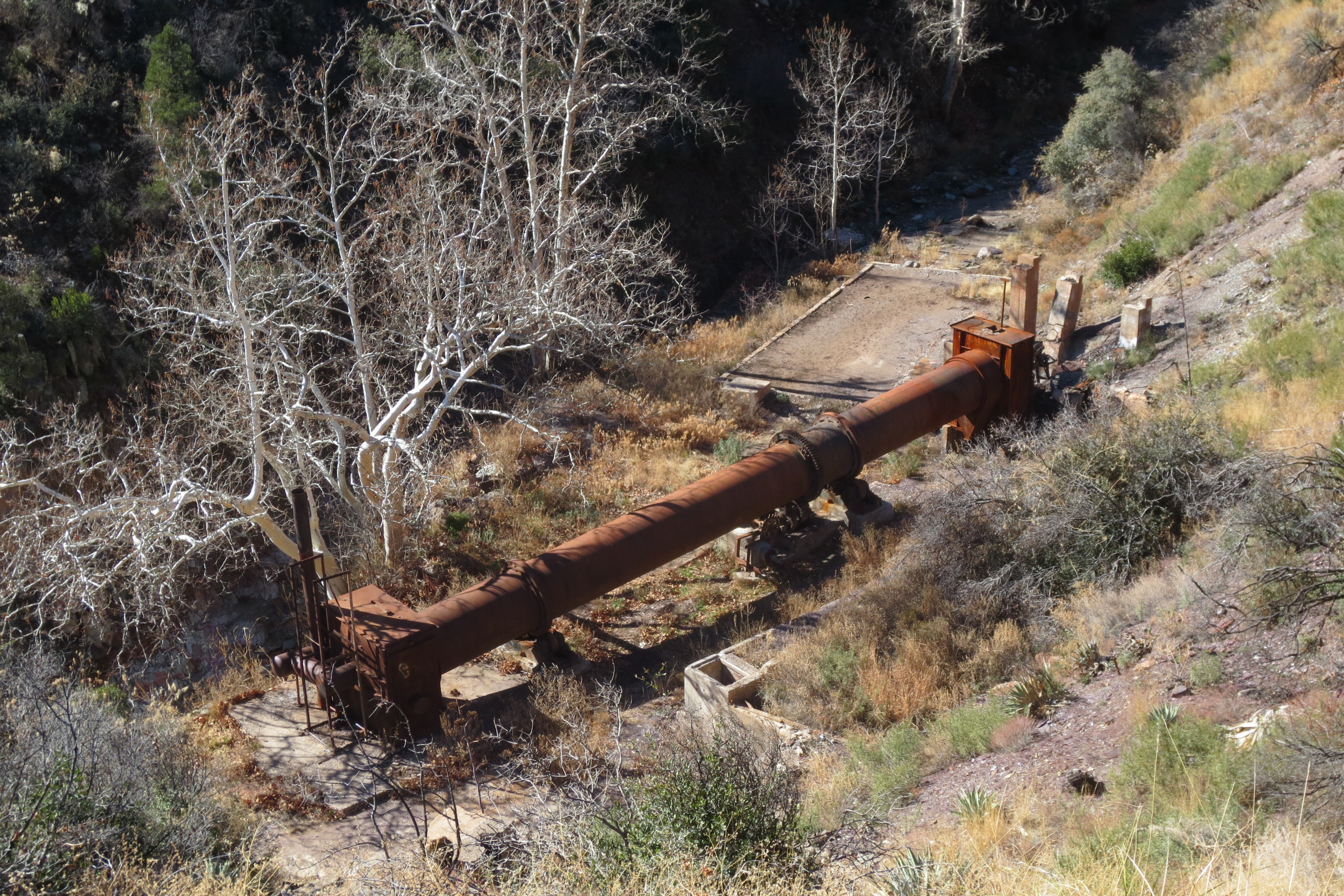
2014-01-01 I think this is the ore separator
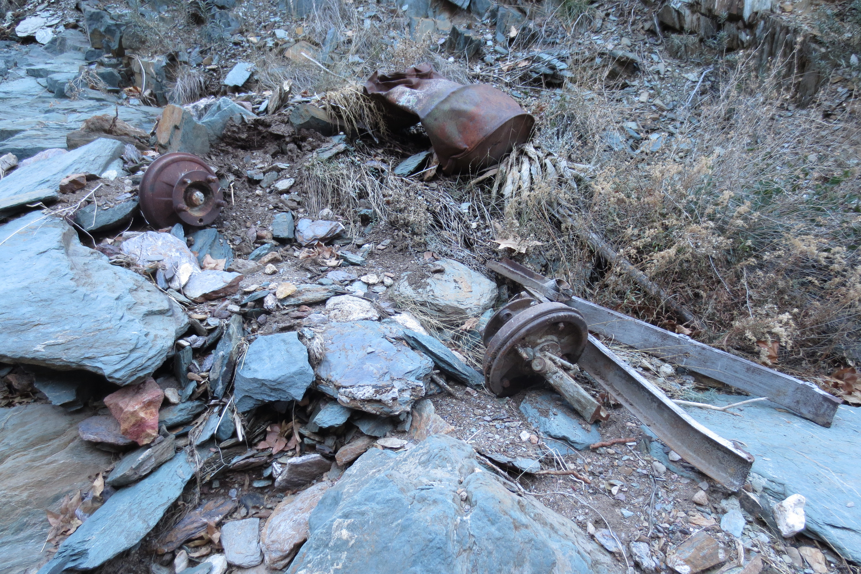
2014-01-01 Here are some wheels to a mine cart
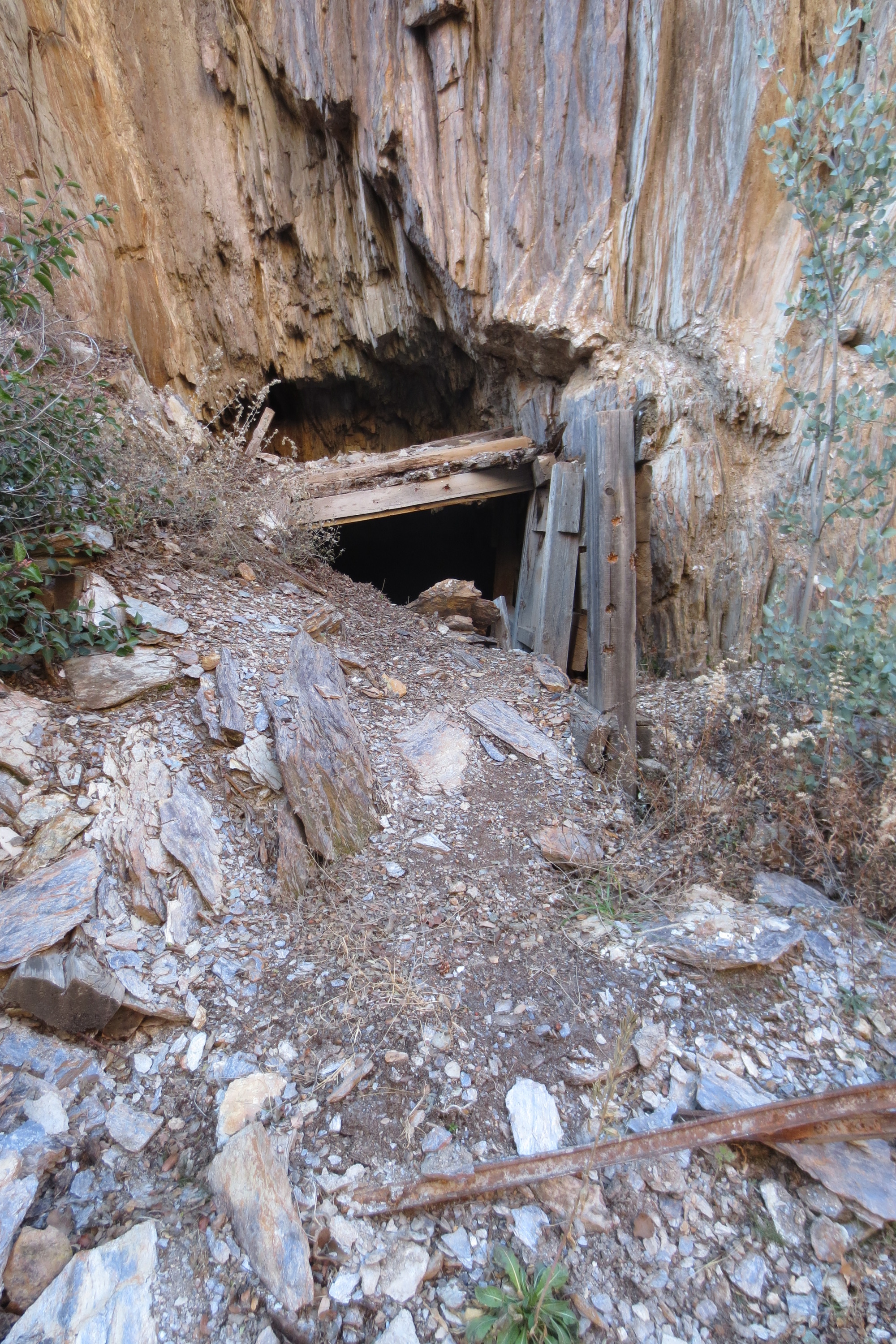
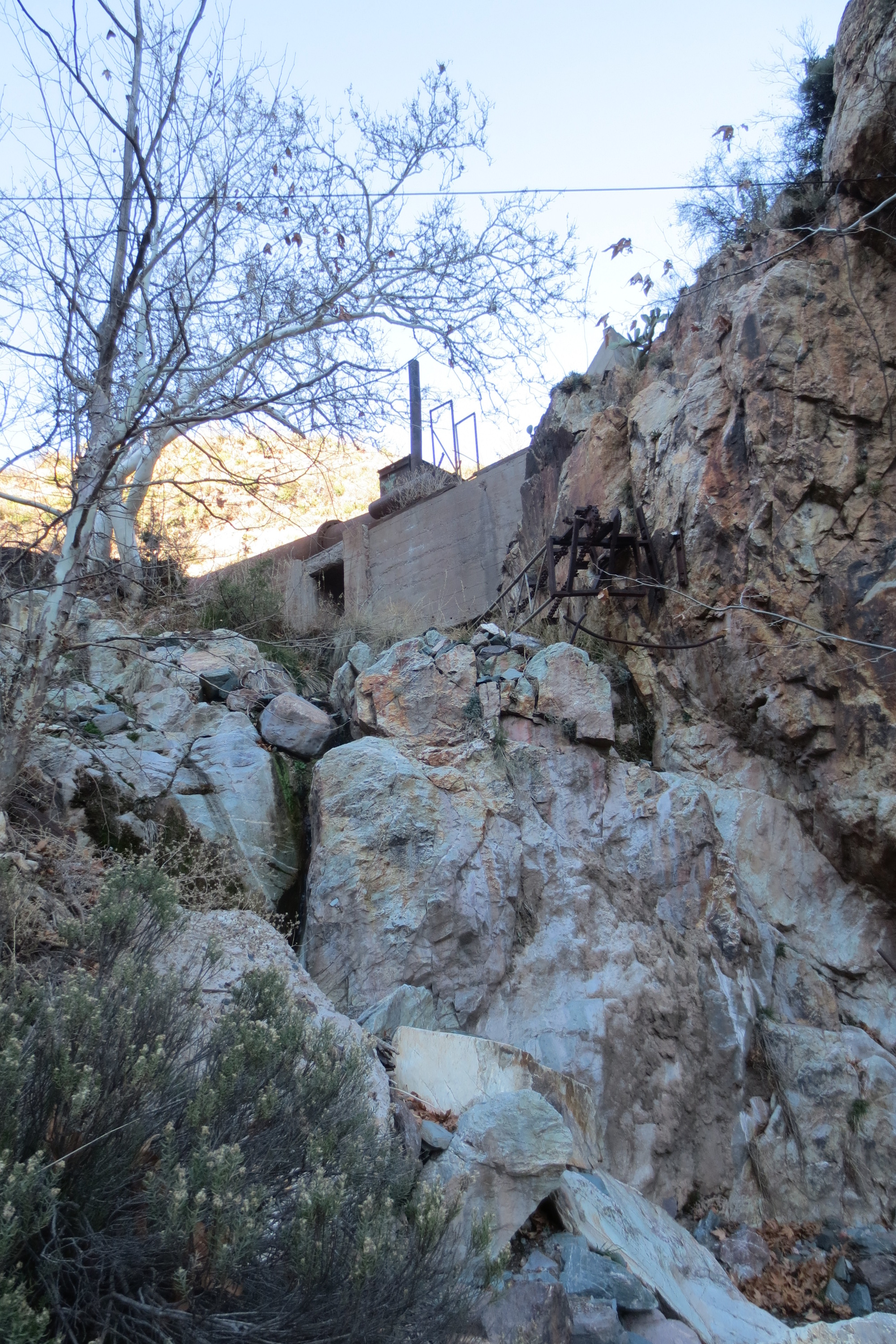
2014-01-01 Another mineshaft entrance

2014-01-01 While target shooting again I jammed my Mosin. I guess I was trying to cycle too quickly and the previous case did not eject properly. I had to get my Leatherman out to recover the rifle

2014-01-01 The 7.62x54r is a serious round, and it pierced this minecart wheel
2014-01-01 Depending on if I am in the shade or the sun is a large difference in temperature. If you look closely in this picture you can see my orange target

2014-01-01 I had just bought a new canister stove, so I tried it out on this hike
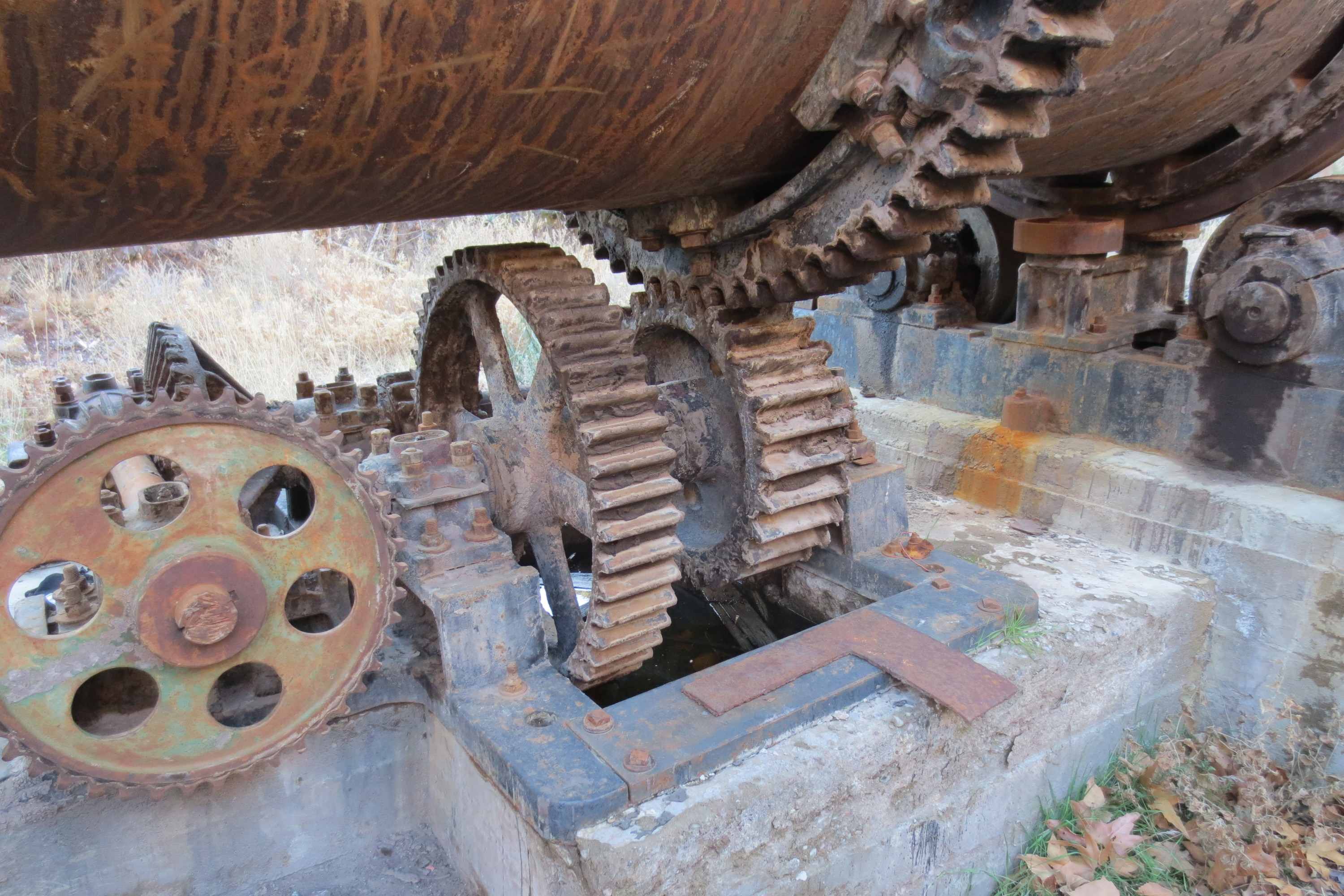
2014-01-01 Lunch was eaten at the separator I saw earlier. I can only imagine how difficult it was to get these supplies up that 4x4 road to build this
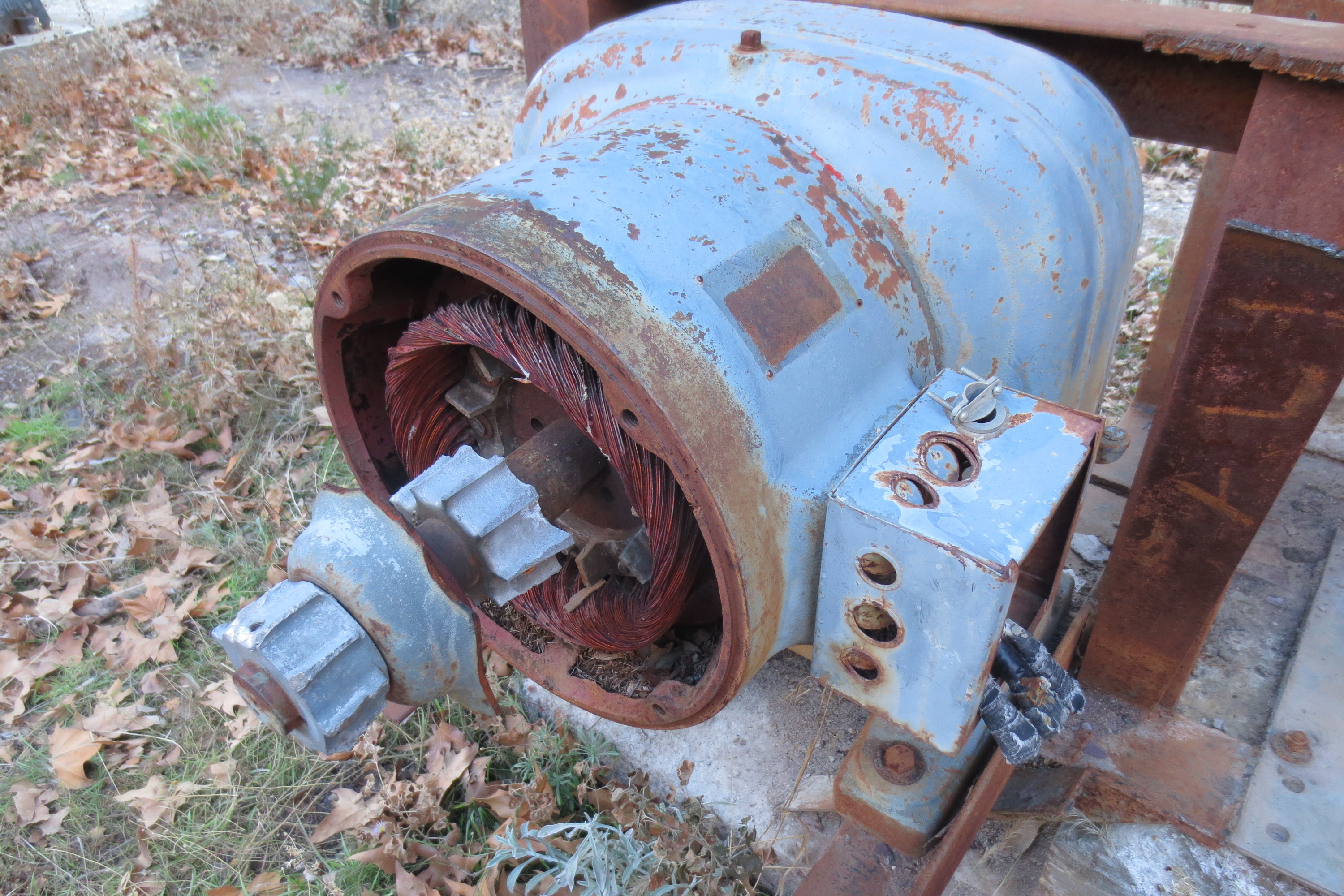
2014-01-01 I am surprised that no one has stolen the copper out of this motor
2014-01-01 Just below from the ore separator you can see a large drop off that I was stupid enough to attempt climbing down. I didn't injure myself but I didn't make it all the way before chickening out; I ended up dirty and tired after this brief scramble
2014-01-04 Petrified National Park, Natural Arches, and Monument Valley
Starting off the new year I decided to check out the Petrified Forest National Park
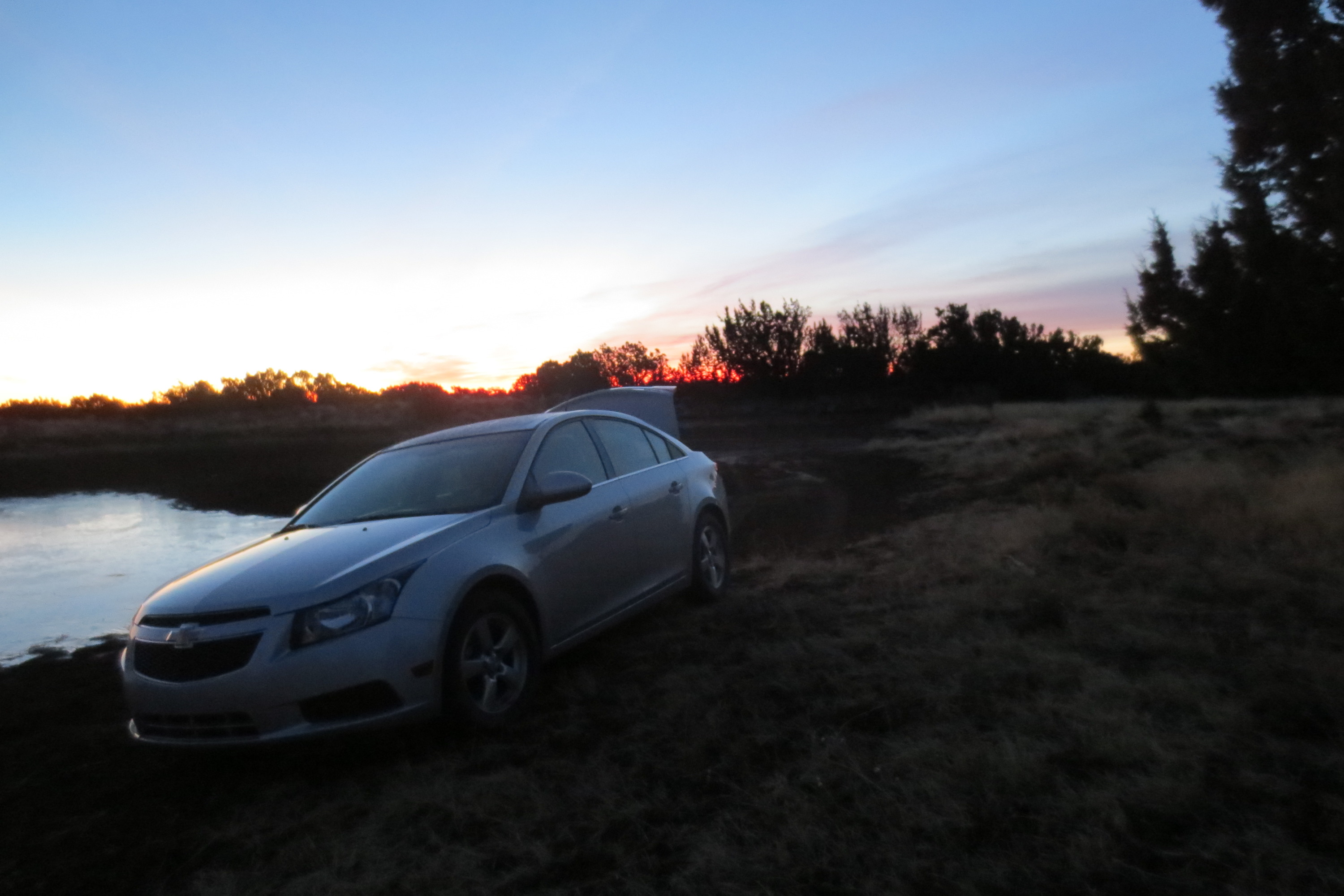
2014-01-04 Packing up my campsite in the Coconino National Forest. That watering hole was liquid when I arrived the night before
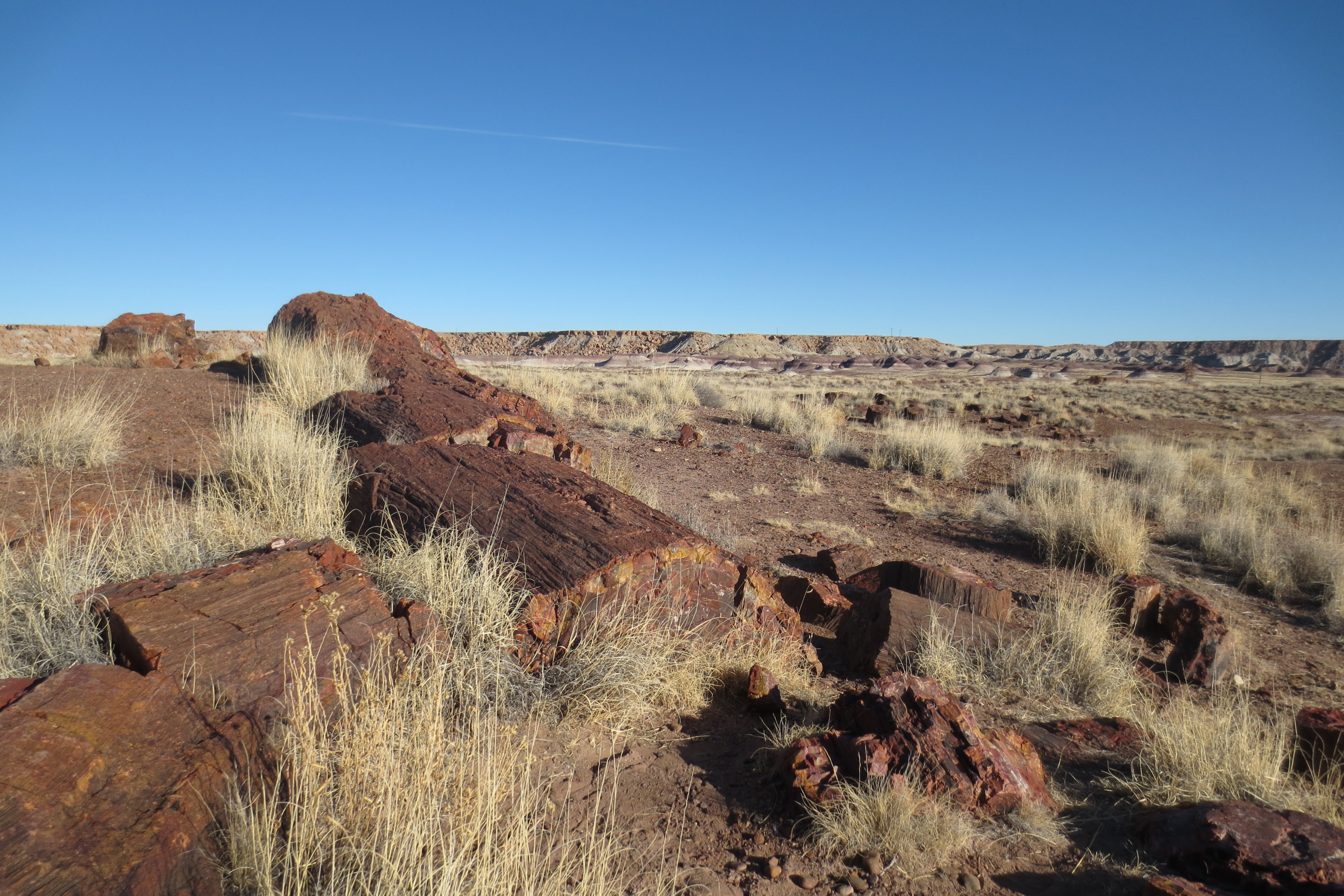
2014-01-04 Heading through the Petrified Forest National Park, there are quite a few petrified logs. This is next to the visitor center in the south side of the park
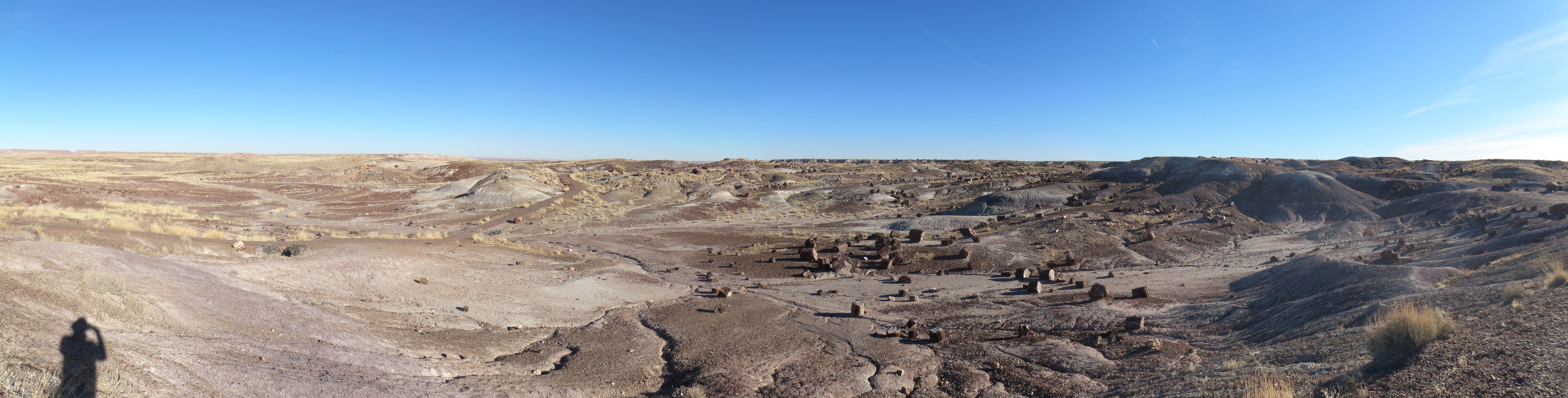
2014-01-04 Stone stumps accented with more stones and dust
2014-01-04 A petrified log forming a bridge. The concrete was put in before the forest service's position of not preventing natural forces on park features
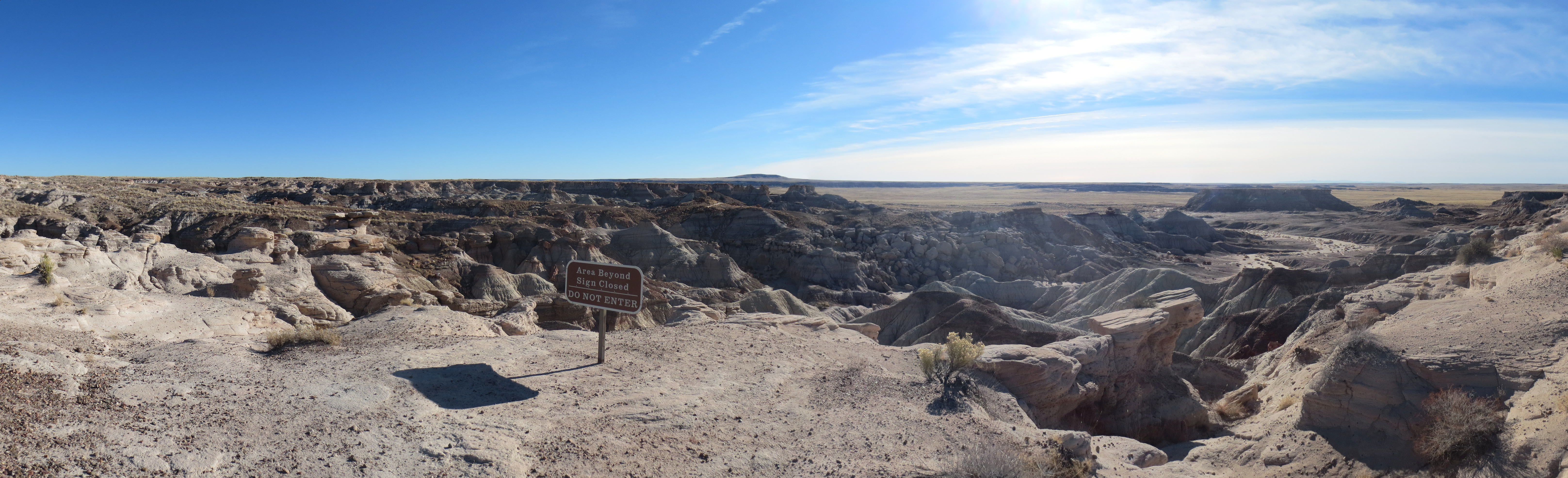
2014-01-04 These canyons look like a lot of fun, but the sign forbids my exploring of them
2014-01-04 This crow is fearless. You can also see the train that cuts through the middle of the park in the background
2014-01-04 Here is a monument to Route 66, with only the telephone poles on the left hand side remaining. The modern I-40 runs a bit to the south
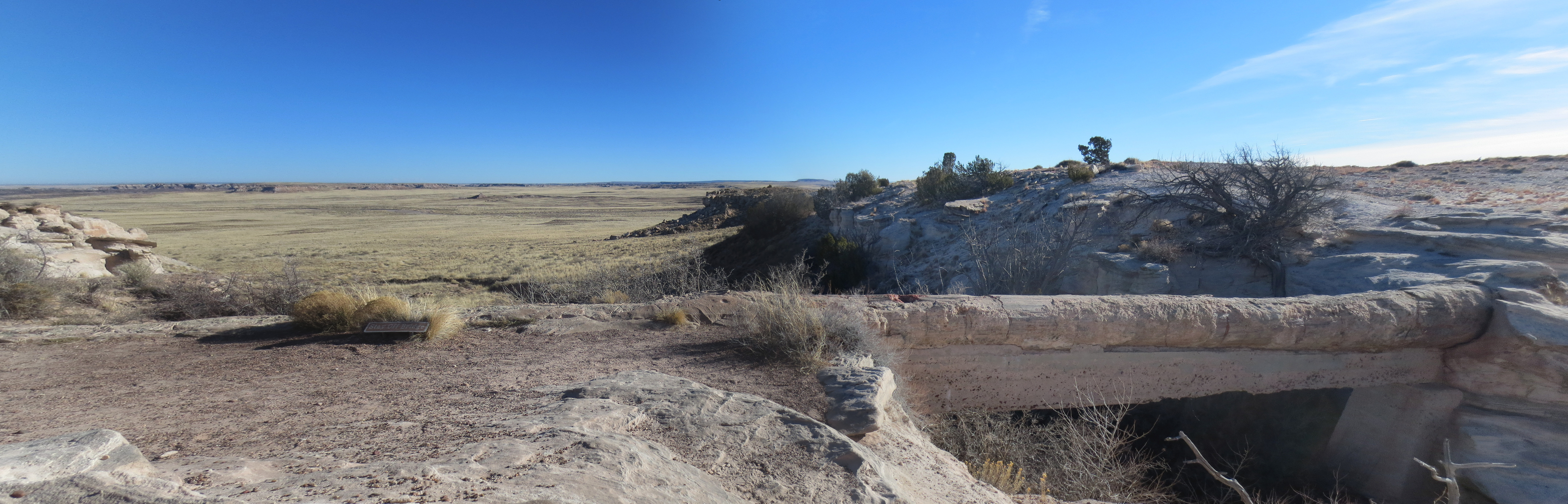
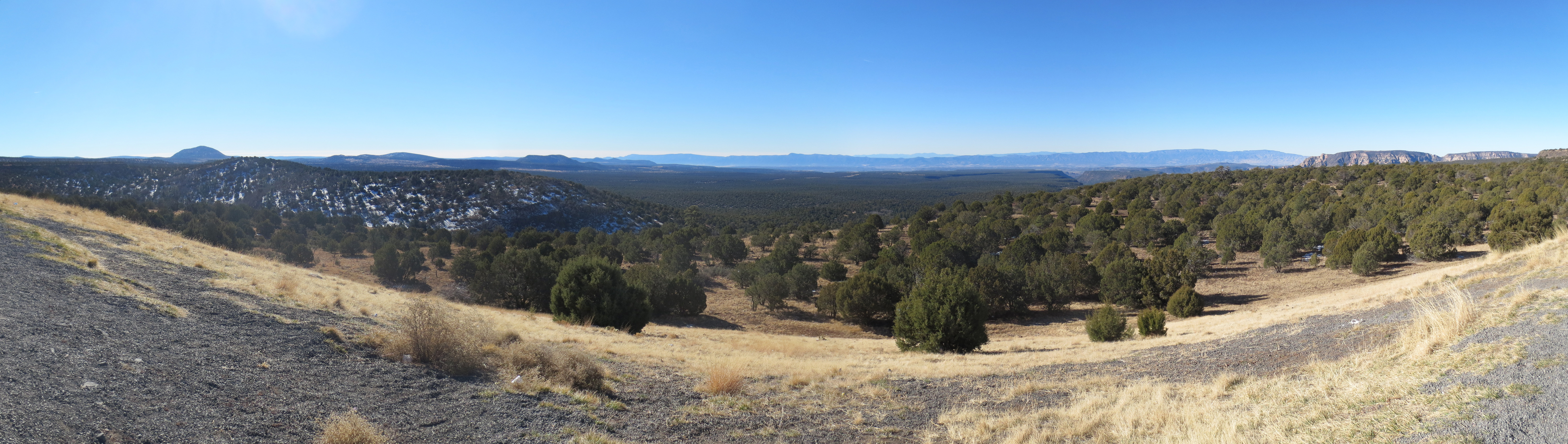
2014-01-04 Another panorama of Arizona, featuring some of the layering in the rocks
2014-01-04 Another panorama of Arizona, featuring a road!
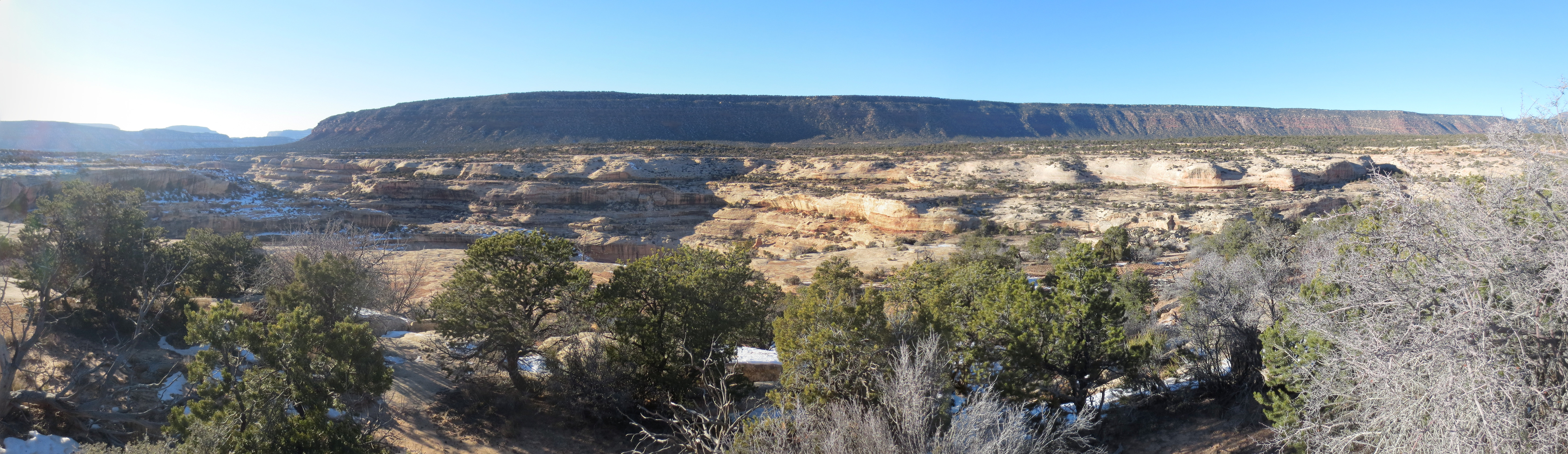
2014-01-04 I drove north from the Petrified Forest National Park, however that is all Navajo Nation until well into Utah. So that is where I went, and I found the Natural Bridges National Monument
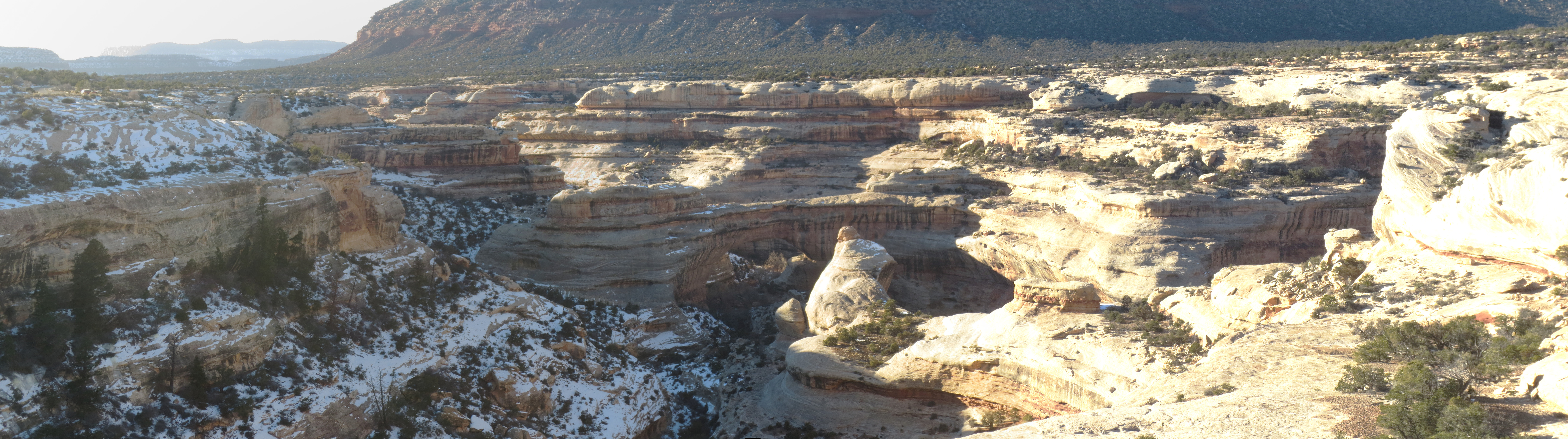
2014-01-04 The Sipapu Bridge
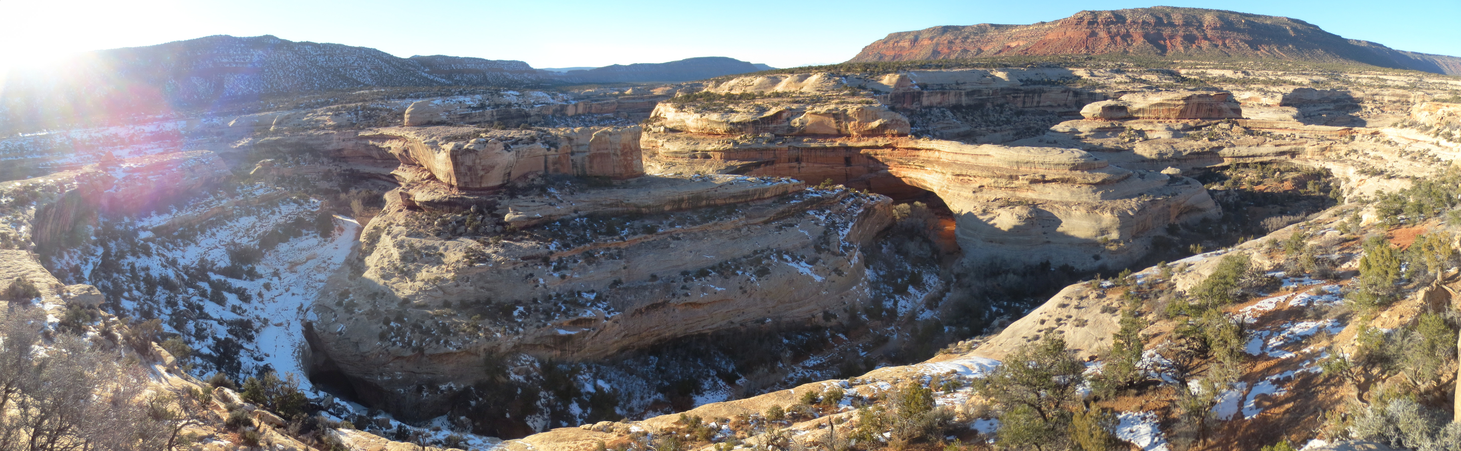
2014-01-04 Kachina Bridge
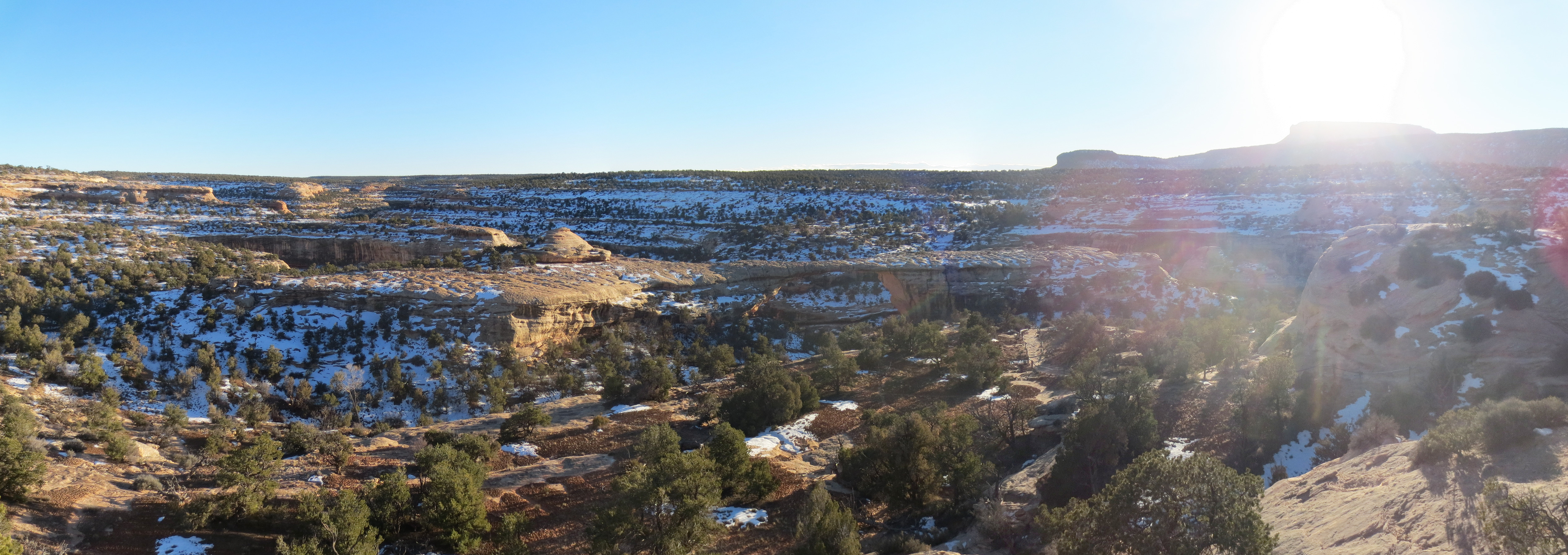
2014-01-04 Owachomo Bridge
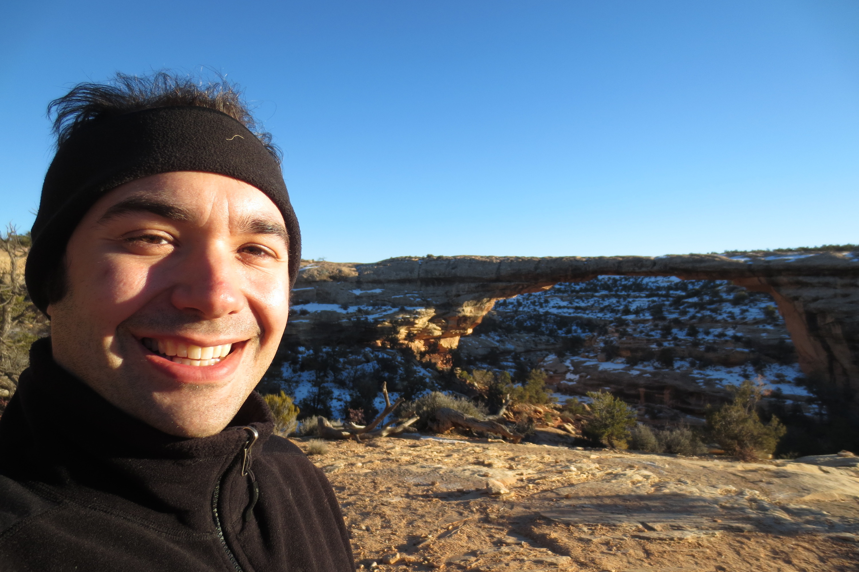
2014-01-04 Our fearless hero hiking down to below Owachomo Bridge

2014-01-04 A creek below the bridge. I spent the night in the campgrounds for this park, and between the windspeed and temperature it was terribly cold; I was waiting out the night in my zero degree bag
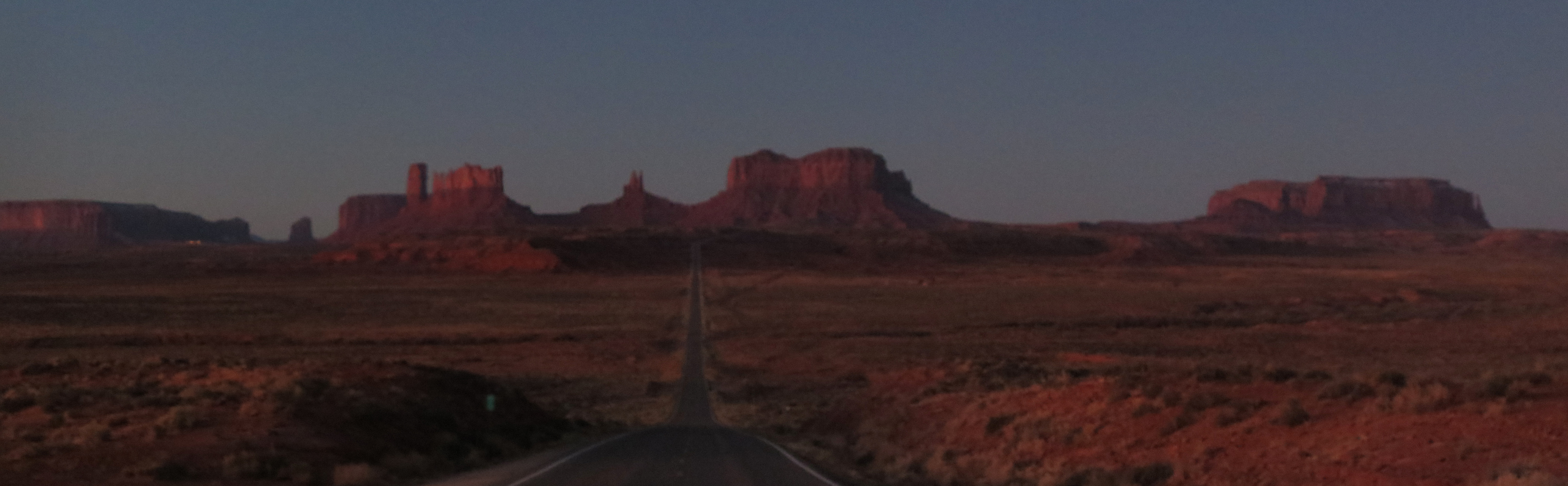
2014-01-05 The night before I went to bed just after dark around 7pm, so I awoke well before daylight and broke camp, heading to the famous Monument Valley inside the Navajo Nation. Driving from the northeast I took this grainy low light panorama just after sunrise
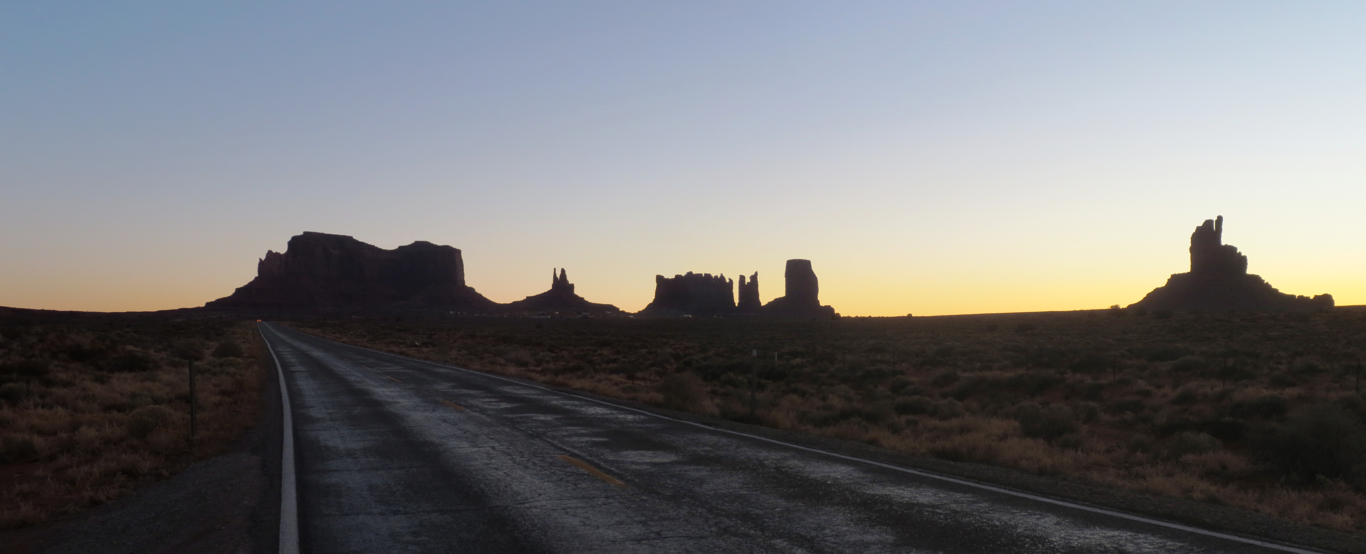
2014-01-05 Looking back for some silhouettes
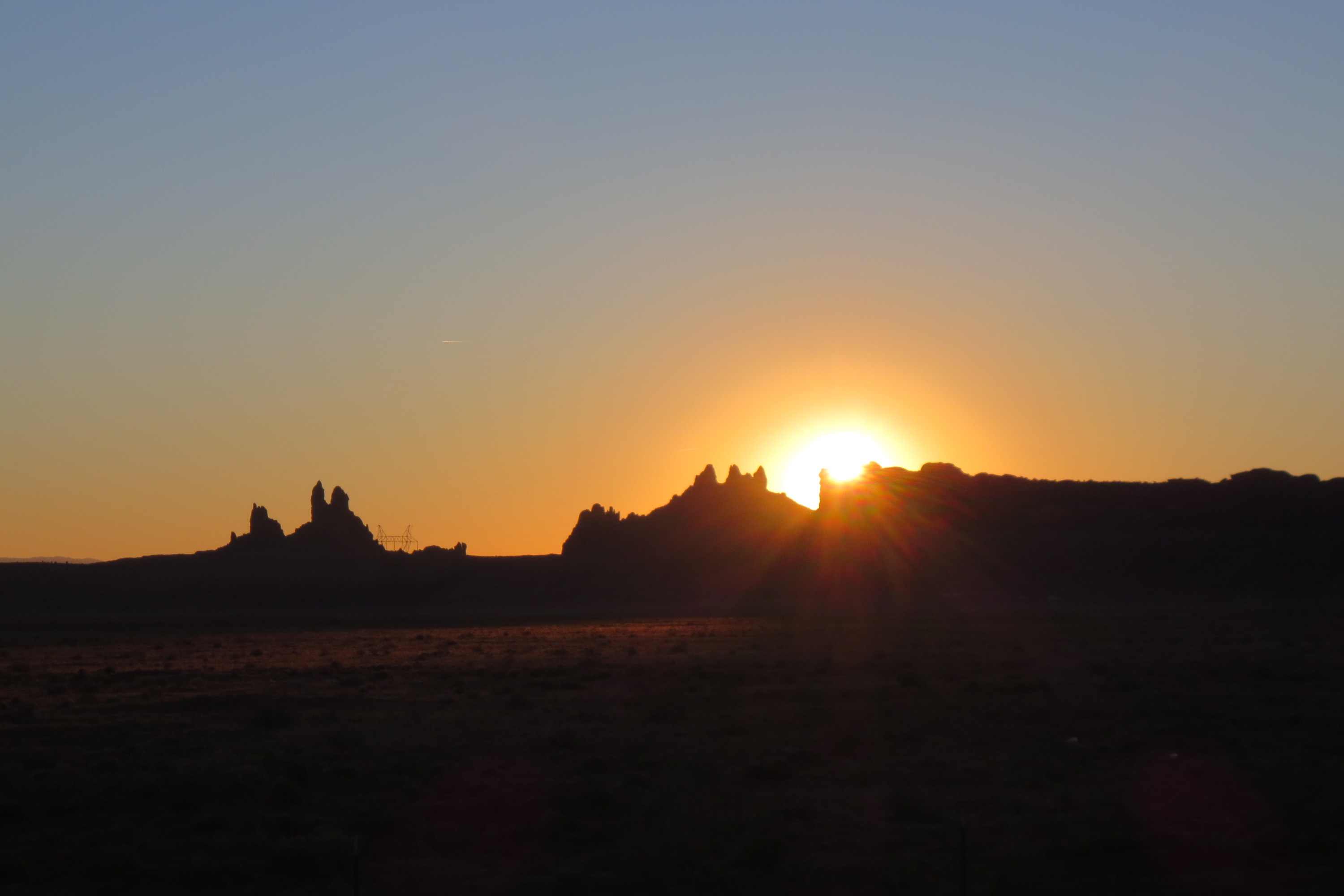
2014-01-05 The sun cresting over a mesa

2014-01-05 Finally some colour now that the sun is out

2014-01-05 Heading towards Flagstaff, the San Francisco Peaks become visible in the distance
2014-01-05 Not stopping in Flagstaff, I stopped for the scenic overlook on the shoulder of I-17 with this picture of the Coconino National Forest
2014-03.22 Death Valley with Tony
Tony and I made the long trek to Death valley and tried to see as much as possible in two days
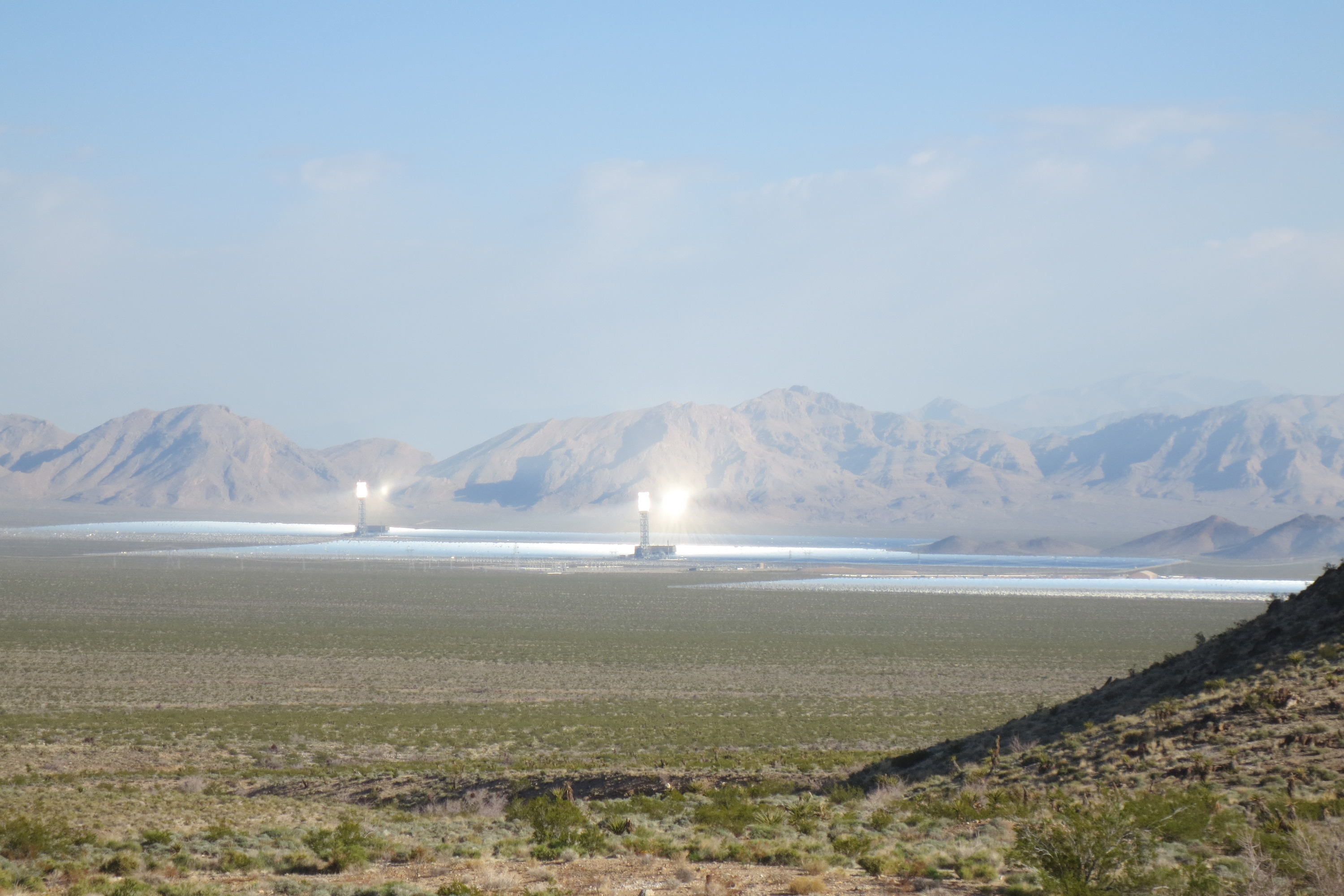
2014-03.22 Early in the morning I was caught off guard when I saw the Ivanpah Solar Power Facility off in the distance
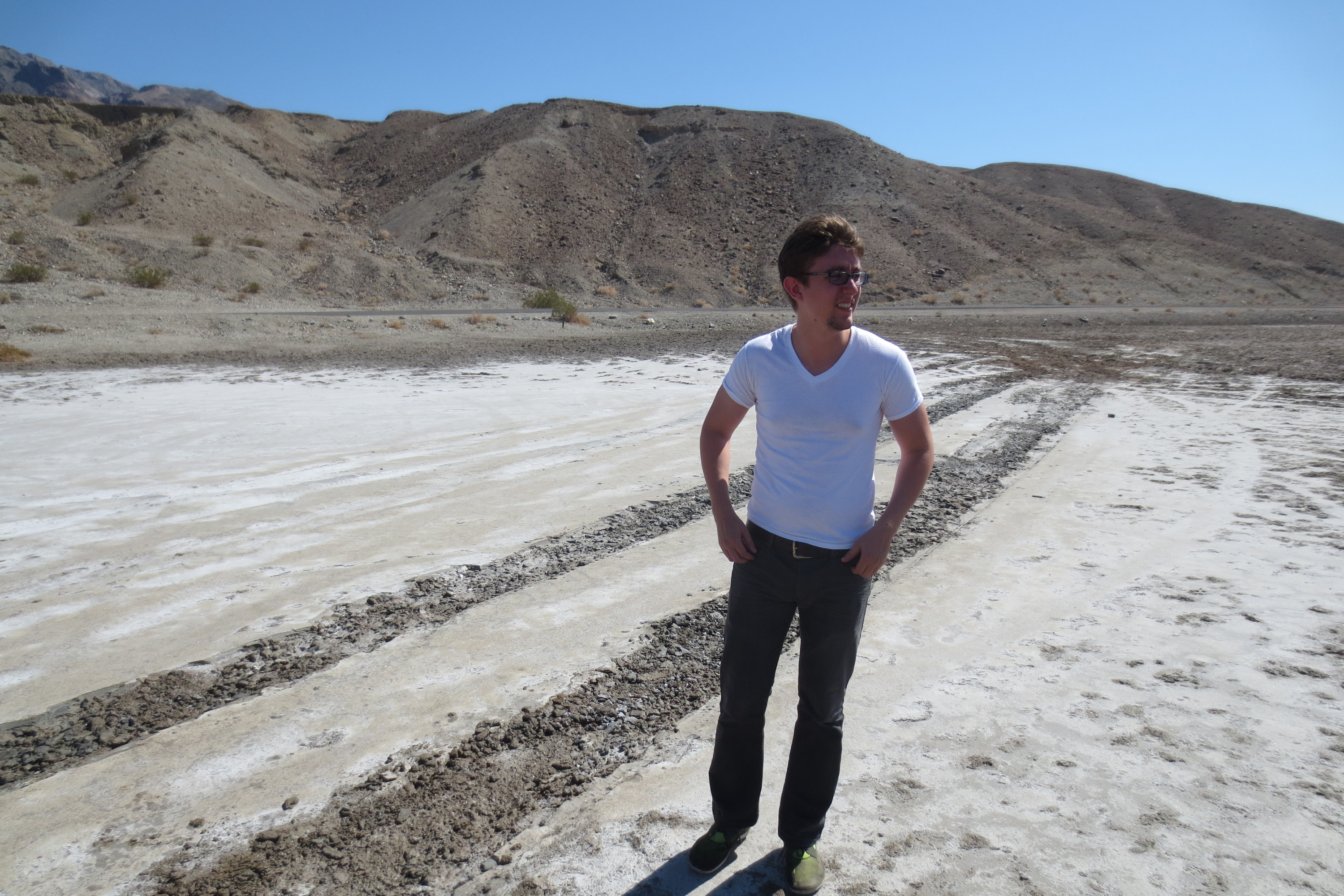
2014-03.22 Tony on a salt flat. I wish I could say my Cruze created those tyre tracks
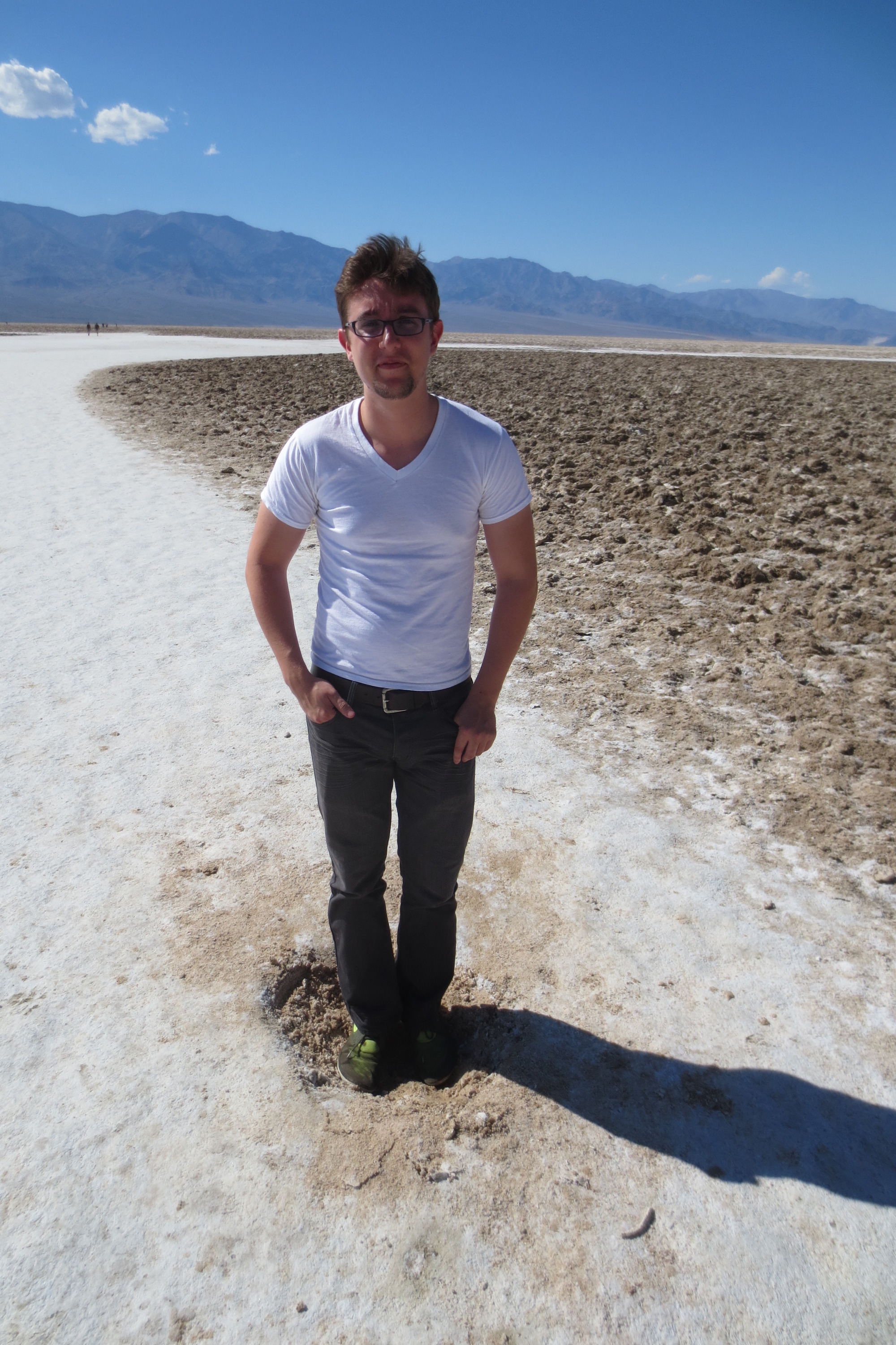
2014-03.22 We visited Badwater Basin, the lowest point in the USA. Tony had to be even lower than the rest of us
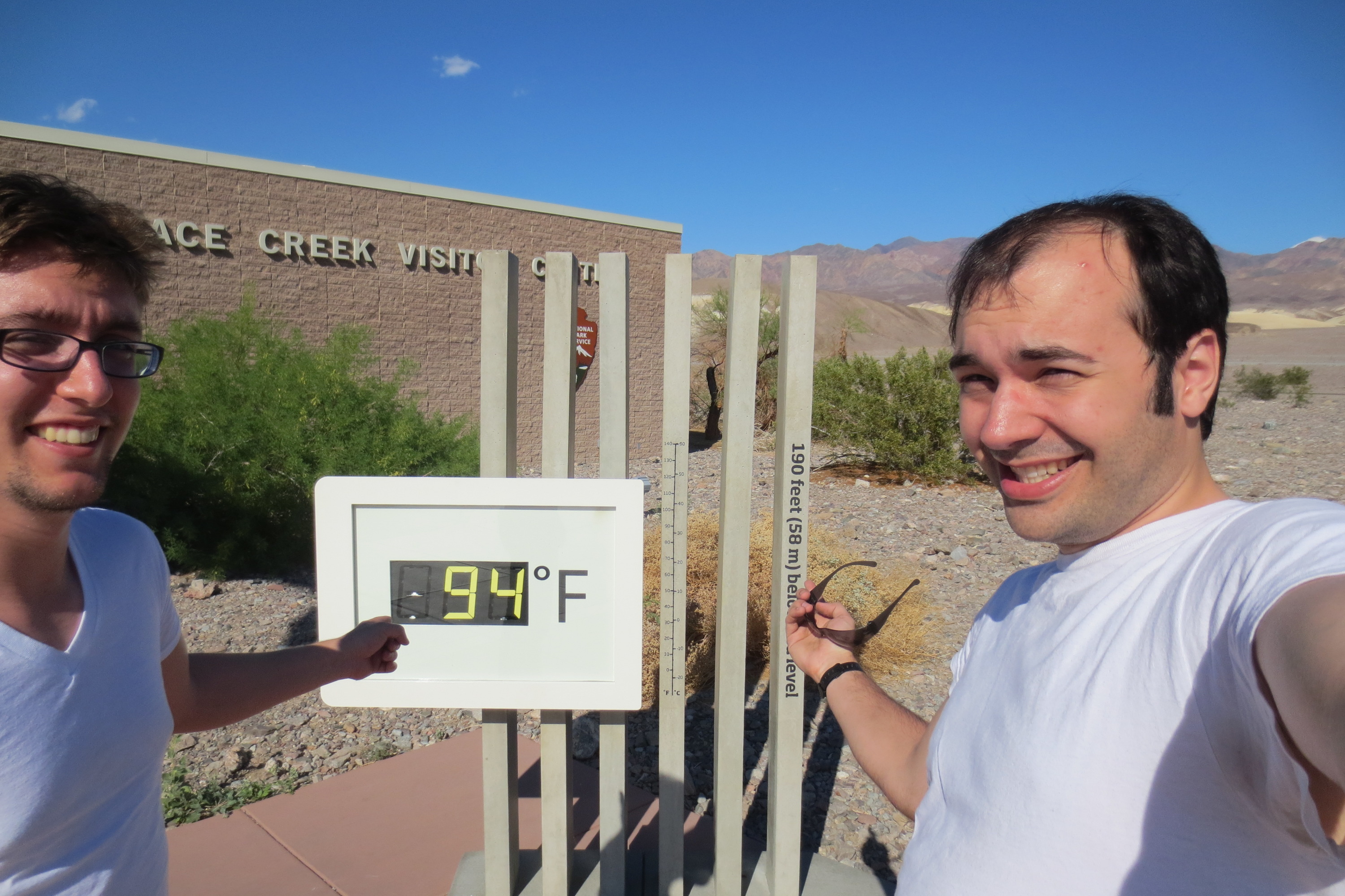
2014-03.22 Too hot for March

2014-03.22 After setting up camp we did some exploring. Here we are checking out some old mining foundations
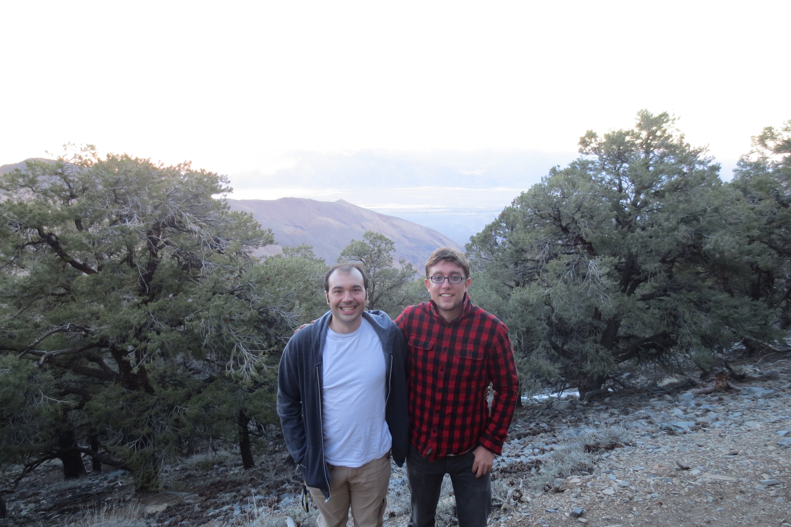
2014-03.22 We were able to make it to the Mahogany Flat campground. Unfortunately ran out of road and daylight so we could not continue on to the highest point in the park - Telescope Peak
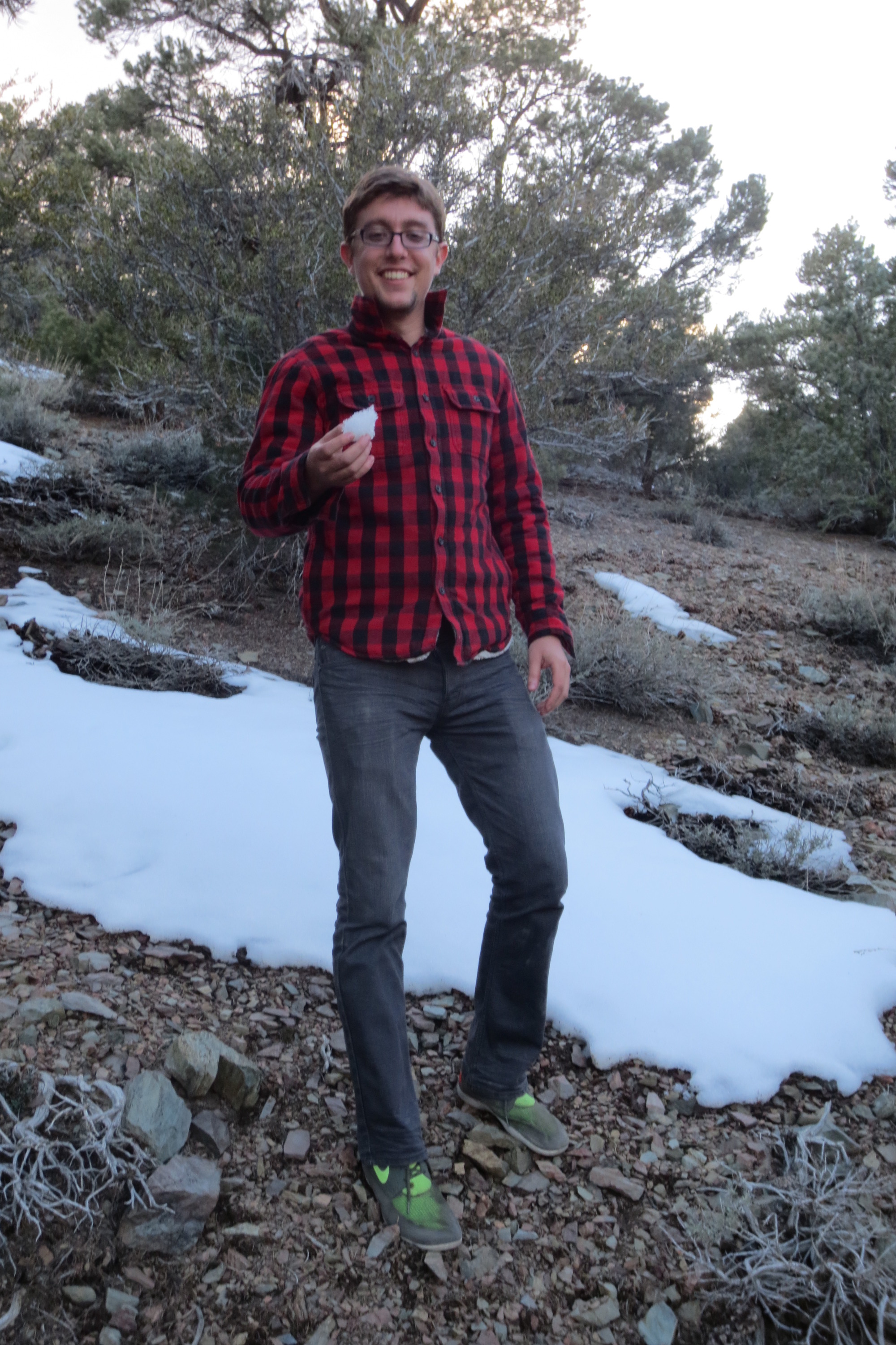
2014-03.22 Snow. We went from -86m to 2500m in just a few hours. Good thing we had jackets
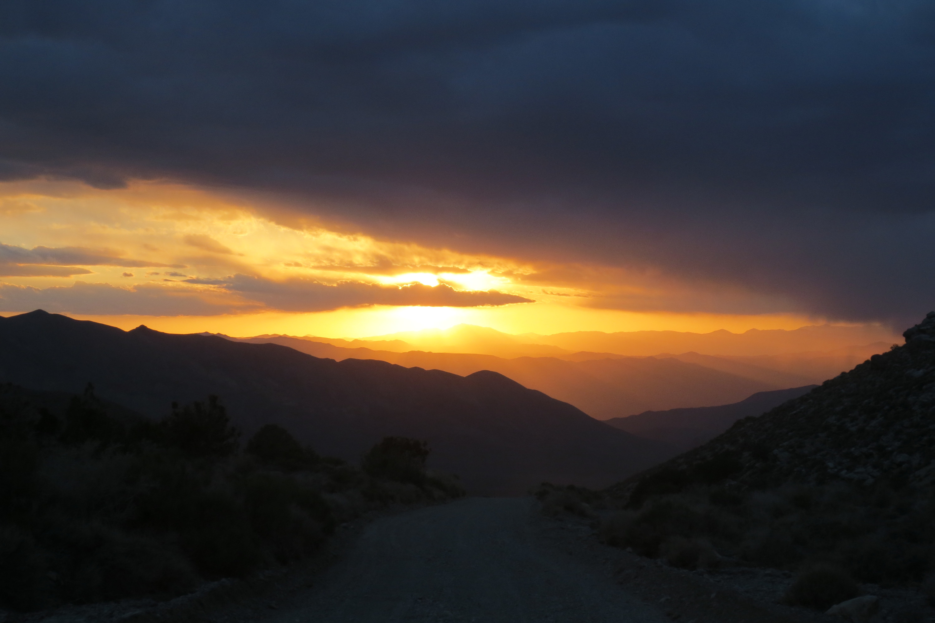
2014-03.22 Sunset on our way back to camp

2014-03.23 The next day we started off by checking out Mesquite Flat Dunes. Lots of sand there
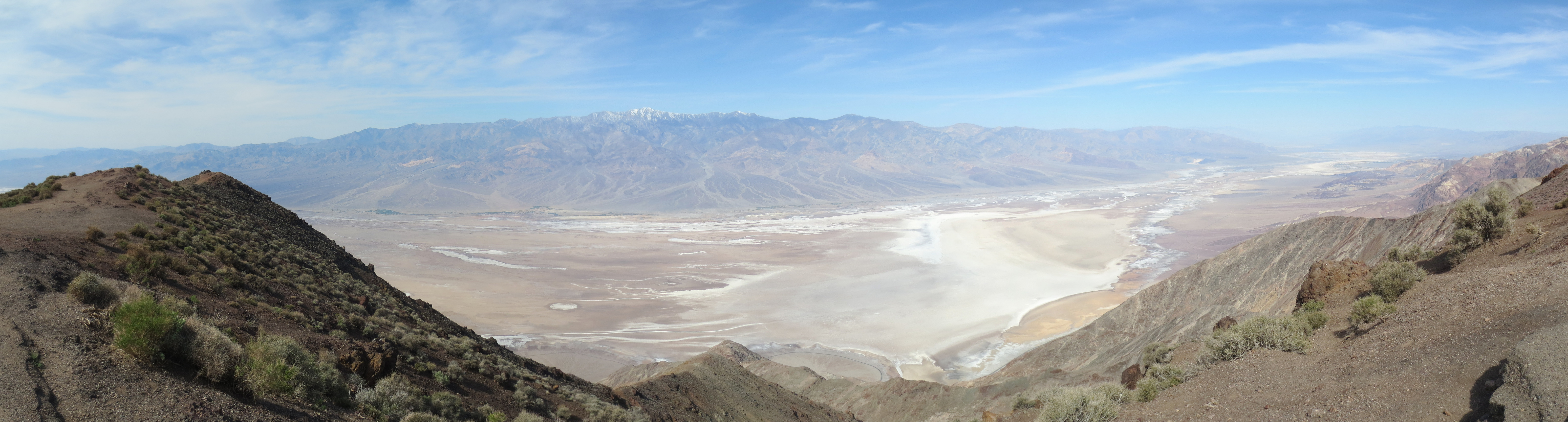
2014-03.23 We finished our trip by asking the Cruze for another climb, this time to Dante's View at 1669m. It has a brilliant overlook of Badwater Basin, and in the distance Telescope Peak is snow covered